Overview about the service
Due to the population growth, there is a serious need to utilize the surrounding resources, such as water, land, fossil fuels, and minerals. The irrational consumption of these resources has an undermining impact on the environment in terms of the depletion and the resulting waste products such as toxic materials, air and water pollutants and greenhouse gases. Environmental monitoring is extremely critical for decision makers and analysts to keep the track of the changes that are occurring to the environment and make sure that it is not affected, in any way, especially nature reserves.
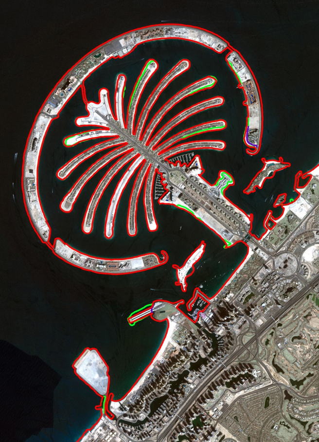
Coastline zones monitoring is significantly essential as these areas are continuously exposed to natural and human hazards such as sand erosion, red tide, flooding and raising sea levels, especially in areas such as artificial islands in the UAE. The high spatial resolution and multispectral bands of KhalifaSat aids in monitoring coastline zones using image processing techniques in three steps which are: Land-Water Classification using NDWI, Binary conversion and Edge detection. Figure9 demonstrates an example of coastline detection that can be extracted from KhalifaSat imagery.